Targeting trout in a river with a history
On The Fly Freshwater
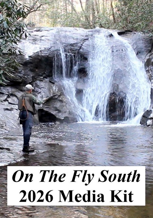
August 2022
Article and featured photo by Matt McGraw
The Jackson River in the Allegheny Highlands of Virginia may be the most popular tailwater fishery in the commonwealth. Sourced in the beautiful, yet remote, mountains of Highland County, it flows southward growing with every seep, spring, brook, and creek tributary until it reaches Gathright Dam where, along with Back Creek, it forms Lake Moomaw.

Gathright Dam is a stone-filled, rolled-earth dam, which serves as flood control and water augmentation for the downstream communities of Covington and Clifton Forge. Gathright also is a bottom-release dam and, with a maximum depth of 152 feet, the released water is cold, oxygenated, and full of tasty food for hungry trout. It is the 18 river miles between the lake and the dam at the Westrock facility in Covington that gets the most attention from anglers, but the Jackson, or the “Jack” as it is colloquially known by some local anglers, has three distinct fisheries.
The Upper Jack refers to everything above Lake Moomaw, including all of the headwaters. It is generously stocked by the Virginia Department of Wildlife Resources with rainbows and browns, but native brook trout can be found in the upper reaches and in some of the tributaries. This stretch of the Jackson lies mostly in Bath County, with plenty of public access points and thousands of National Forest acres to explore.
A special treat for fly anglers is the Special Regulation section located at Hidden Valley. From the parking area it is a two-mile hike upstream to the Special Regulation section, which is home to a good quantity of relatively unpressured trout. The Upper Jack is freestone water, which fishes well with attractor patterns, small streamers, and terrestrials when they are in season.
The Middle Jack below Moomaw is the most popular stretch of water. Marketed as a “fly fisherman’s paradise,” it is an 18-mile portion of the river. Access is tricky and it is best fished by raft. This is classic tailwater fishing and perhaps the best Virginia has to offer.

The water from the outflow of the dam is warmer than expected in winter, cooler than expected in summer, and pushes a buffet of trout food downstream. When combined with reliable hatches and room to roam, a population of trout is cultivated that is pressured, wary, and produces surprisingly large fish. The trout in here are wild and self-sustaining, but also wily and suspicious, so bring your “A” game.

The Middle Jack has several public access points and covering water is often the name of the game. Guided fishing has increased in recent years here, but don’t let that be a deterrent. Let it be a testament to the quality of this year-round fishery. Expect to land some beautiful wild rainbows with deep purple parr marks. If you hook into anything larger near an undercut bank or in the lee of a boulder, it may be one of the hook-jawed, butter-bellied brown trout.

The Lower Jack may be one of the best kept secrets in the region. Admittedly, I cringe a little with guilt as I write this. Immediately downstream of Westrock, where U.S Highway 60 crosses the river and Dunlap Creek enters the Jackson, things get interesting. From here downriver to the James River, it is a respectable warmwater fishery which sees little pressure. Fish diversity increases significantly, adding an exciting element of surprise to every strike. On a recent trip to the Lower Jack, I landed smallmouth, largemouth, rainbow trout, rock bass, fallfish (a member of the chub family that is nicknamed the “tarpon of the commonwealth), and a carp in one day. The smallmouths are typically in the 12- to 17-inch range, but larger smalljaws are present. The smallmouth here are the color of shaded moss with bronze-shielded backs and aggressive warpaint radiating from crimson eyes.
As with the upper tailwater, this stretch is best fished by watercraft. There are plenty of places to beach and the boat launches are conveniently distanced. Favorite access points here are City Park in Covington and Mountain Gateway Community College in Clifton Forge.
The Details
Due to some landowners along the Jackson holding title grants that pre-date the American Revolution, access regulations can get tricky. Basically, the state of Virginia owns the bottom of the river, except in areas where King George III granted rights to the river, its waters and fish to private landowners. Here’s what the Virginia Department of Wildlife Resources recommends.
“Below Gathright Dam, six public areas provide access to 18 miles of legally navigable water to Covington. Riverfront land owners have brought successful civil trespass claims against anglers fishing in the two portions of the river highlighted on the map (see the Maps section). In light of these court actions, anglers may find it advisable to seek the permission of the riverfront property owners.”
Special Regulations Areas
Upper Special Regulation Area
That portion from the Forest Service swinging bridge, located just upstream from the mouth of Muddy Run, upstream 3 miles to the last ford on Forest Service Road 481D. This section is stocked several times a year with catchable-sized trout and good populations are always present (a trout license is required to fish in this stream from October 1 through June 15). This section can only be reached by foot travel, either from the Hidden Valley area or off Route 623 and FS Road 481. Note: Multiple hook artificial lures are permitted.
Tailwater Special Regulations Area
From Gathright Dam downstream to the Westvaco Dam at Covington: No rainbow trout 12 to 16 inches; no brown trout less than 20 inches; 4 trout (combined rainbow and brown) creel (harvest) limit per day, only 1 of 4 can be a brown trout over 20 inches. All rainbow trout between 12 and 16 inches and all brown trout less than 20 inches must be released immediately. The 7-inch statewide minimum size limit does not apply to rainbow trout in this section of river. Bait allowed.